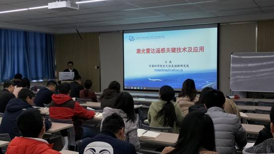
At the invitation of Prof. Lu Lei from the College of Earth and Environmental Sciences, professor Wang Cheng from Aerospace Information Research Institute, Chinese Academy of Sciences, came to Lanzhou University for academicexchanges on December 17, 2019. He made an academic lecture entitled “Key Technologies and Applications of Lidar Remote Sensing” in lecture room 502, Qilian Tang.

The lecture covered the introduction of lidar remote sensing, the imaging mechanism, data processing technology, and industrial application. In the lecture, Prof. Wang elaborated on the characteristics of lidar full waveform data, discrete point cloud-data, and photon count data. He also systematically introduced domestic and foreign lidar satellite programs. By combining with his team’s research work, he concentrated on the introduction of the laser point cloud data processing process and the mainstream algorithms involved. Besides, he showed the application of lidar on forestry surveys, topographic mapping, digital cities, and power line inspection. In the end, Prof. Wang introduced the point cloud Rubik's cube, waveform Rubik's cube, and power line inspection software briefly, which were independently developed by his team.
After the lecture, focusing on the issues such as point cloud data processing, a fusion of microwave remote sensing and lidar data, and the application of lidar in the forest survey of Qilian Mountains, teaches, students and Prof. Wang conducted an in-depth discussion.